For more on Cape Alava, see our Cape Alava page.

06/17/09 - Cape Alava - Rough Going

We were out at Cape Alava to take advantage of the good tides. The trail is much as we remembered it, amazingly green, rising and falling, then opening out to the meadows before descending to the sea. The park service has done some good work repairing the boardwalks which were getting a bit spotty, so the three plus mile walk from the Ozette Ranger Station to Cape Alava was easier than the last time, but the three miles along the beach from Cape Alava to Sand Point were harder. The beach was rough going with much more driftwood and much less sand. Much of the walk was on rocks and stones. At least the seaweed was dry, and nothing was very slippery. We made our way from fallen tree to fallen tree, passing through their branches like the ribs of a great carcass. There were no stretches of smooth sand until we were nearly at Sand Point.

The trail to Cape Alava

View of Cape Alava

The tide was out.

Rocks and stones.

At the edge of the world

Yes, the tide was out.

A seastack with roses

A great deal of driftwood

A parting view

Tiarella and mushrooms

A great deal of Pacific dogwood

Keywords: cape alava, tides


05/13/07 - Cape Alava Update

We were just out at Cape Alava and took the 9+ mile loop from the Lake Ozette ranger station to Cape Alava, then down along the beach to Sand Point, and then back inland to the ranger station. We went at a 0.5 foot low tide, but even then, it wasn't easy going, especially with all the fallen trees along the northern part of the beach hike.

Ahlstrom's meadow was in bloom, the ocean lovely and mysterious, and this time, we found the mysterious petroglyphs. The last time we looked, even the ranger was stumped, but this time, there was a school group, and there were the petroglyphs, graven on the rocks. To find out more, and see our new panorama of the beach, read our Kaleberg Report on Cape Alava.

Keywords: cape alava, petroglyphs


04/10/06 - New Tide Tables for Hikers

We've updated the tide tables for Cape Alava, La Push (Mora and Third Beach) and for the Dungeness Spit. We're trying out a new display format with less irrelevant cruft, and the good hiking days marked out in green.


Keywords: tides, cape alava, la push, dungeness spit, dungeness


TideCal Software

08/05/05 - TideCal - Tides for iCal

We often like to hike out the lighthouse at Dungeness Spit or take the Cape Alava - Sandy Point hike out near the northwest corner. These hikes take you a long way along the water in the Strait of San Juan de Fuca or along the Pacific, and while they are always wonderful hikes, they are best done when the tide is low and the sun is in the sky. Sometimes we check the tide tables to figure out when to go hiking, but sometimes we forget to check the tide tables, and we don't get to some of our favorite beaches.

Now, Kaleberg Symbionts has a new software solution to this problem. It's a simple program called TideCal for Macintosh users that lets you generate an iCal calendar file with just the tides you want. We want low tides, between noon and 3PM, so we can hike and get back in time for dinner. In general, tides under 3 feet are best, so we've put those tides on our calendar. Maybe we won't take advantage of one particular tide, but now we won't miss out just because we forgot to check the tide tables.

Keywords: software, tides, beaches, cape alava, dungeness


06/01/05 - Tide Finder for Finding Good Tides

While there are many programs for producing tide tables, there do not seem to be any programs for finding a suitable tide. For example, if you want a low tide during the day for exploring Cape Alava or walking the Dungeness Spit, you have to wade through listings of high and low tides. Tide Finder program is based on FlaterCo's XTide 2.6 package, and provides a Mac OS X friendly user interface for specifying a tide search. You specify a tide reporting station, a range of dates, a desired range of times and the desired tides, high or low. It gives you a hit list, a calendar and a tide graph.

Keywords: software, tides, beaches, science, cape alava, dungeness spit, second beach, dungeness


06/24/04 - The Fawns of Cape Alava

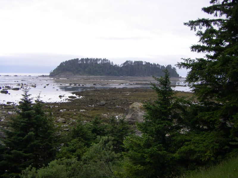
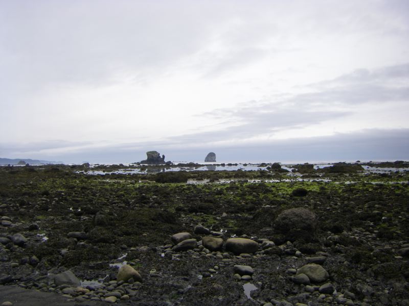
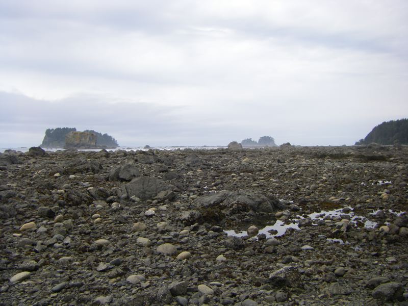
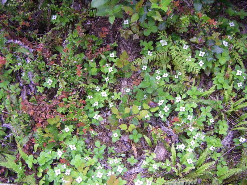
Cape Alava is at the far western edge of the North Olympic Peninsula, so it is a bit of a drive. However, it is well worth it. There is a hike from the corner of Lake Ozette, through rainforest and meadow to 
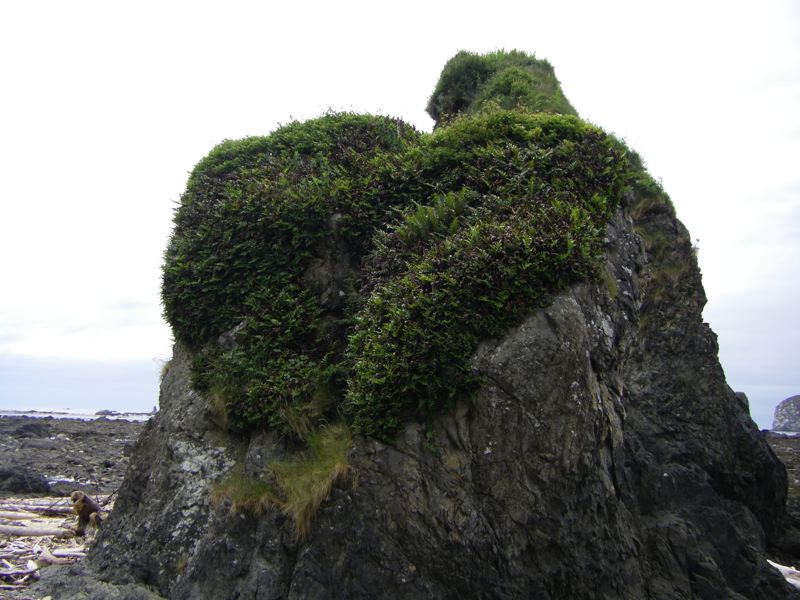
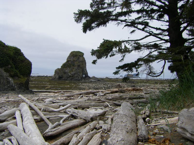
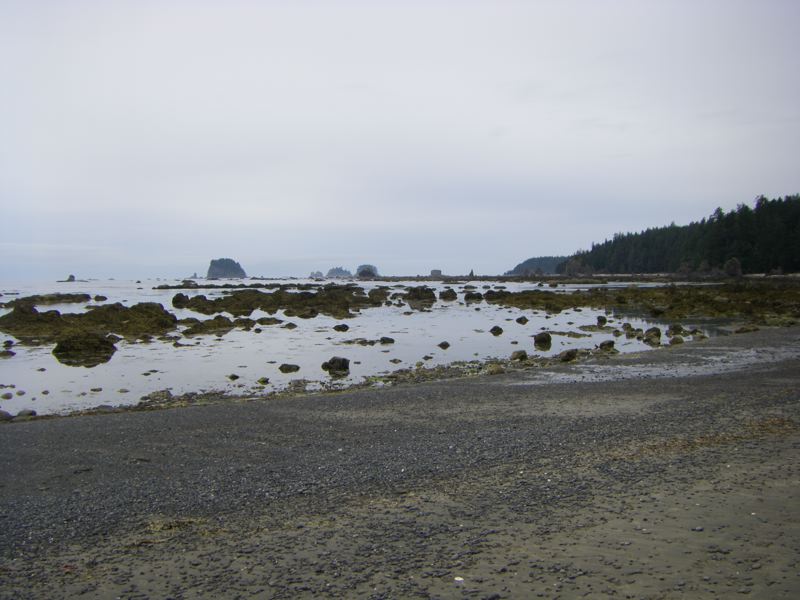
the Cape, then south along the beaches with their mysterious sea stacks and tide pools to Sandy Point, and then back along a different trail to the ranger station.

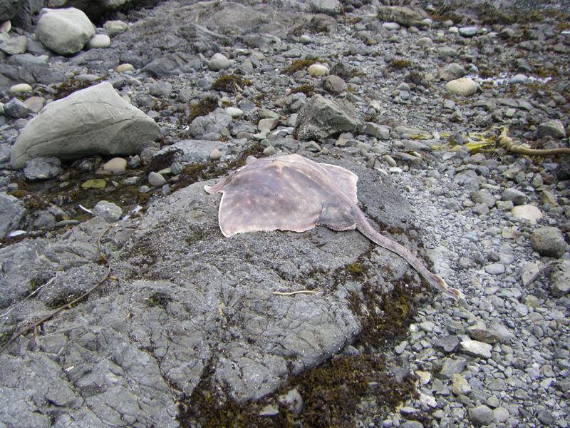
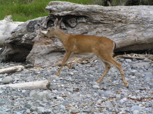
To the right, you can see one of the seasonal charms of the area. The deer, even the fawns, are relatively unperturbed by overly excited photographers. We saw two fawns with their mother (presumably), and we saw a river otter on the Hoko-Ozette Road back home. We also saw a little salt water turtle and a large striped frog.

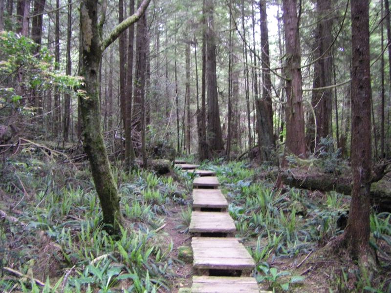
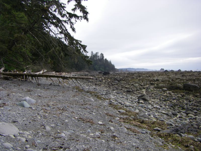
Today, the walk was easy. The tide was low, well below one foot while we were there, so it was easy to go rock hopping around the points. It was also dry, so the boardwalks weren't slippery. Finally, it wasn't too sunny, because the beach can get a bit oppressive with the full sun bouncing off the Pacific.

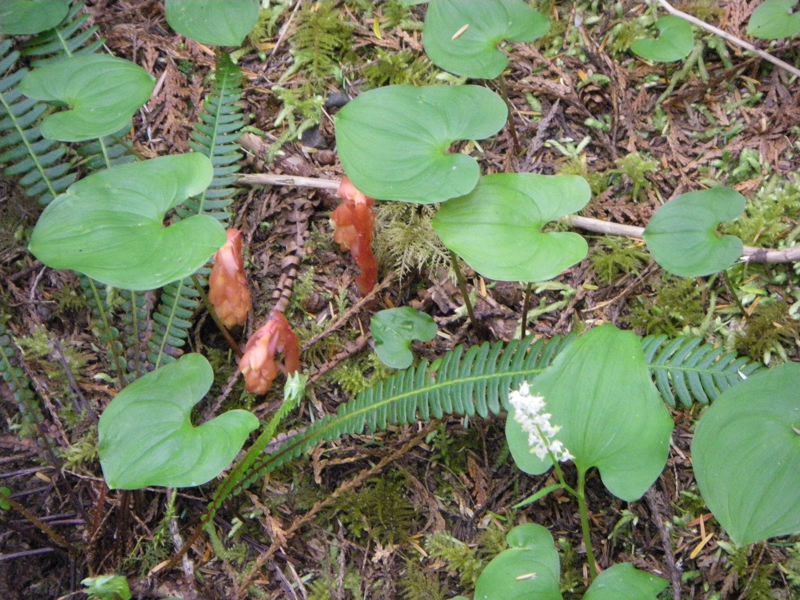
We have as yet to find the petroglyphs, but we'll keep looking.

For more on the trail, see our web page for Cape Alava.
Fawn at Cape Alava

Keywords: animals, cape alava, beaches, petroglyphs