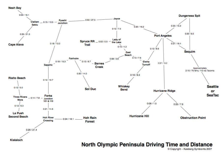
Here is our driving time and distance map for the North Olympic Peninsula. The distances are generally from Google Maps, but the driving times are based on our own experiences in the area. (Google Maps has some weird ideas of how fast one can go on certain roads). This map mentions a number of locations that do not appear on any other map, such as Elwha Turnoff and Hoh River Crossing. These locations are generally at junctions near the landmark, junction or town indicated.


© Copyright Kaleberg Symbionts 2007