To be honest, we have barely begun to explore the possibilities. Every time we go to Sol Duc, we walk past the falls and up the side valley to Deer Lake. If the snow has melted enough, we head higher to The Potholes. Then, we eat lunch and turn around and head back.
TRAILHEAD
Take Route 101 west past Lake Crescent and go up the hill. The Sol Duc Road turn off is near the top of the hill. Go past the Park Ranger station and go to the end of the road. If you want, you can stop off a the Sol Duc Hot Springs Resort, which has food, clean bathrooms, lodging and sulfurous hot springs.
THE RESORT
The Sol Duc Hot Springs Resort has a website.
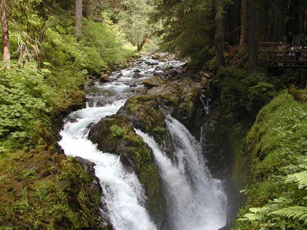
Sol Duc Falls is a short walk from the trailhead and is definitely worth seeing. From the bridge you can see the full power of the falls, hear the roar of the water through the rocks and feel the spray and thunder.
CHECK TRAIL CONDITIONS
It is usually worthwhile to check the trail conditions, particularly in the shoulder season.
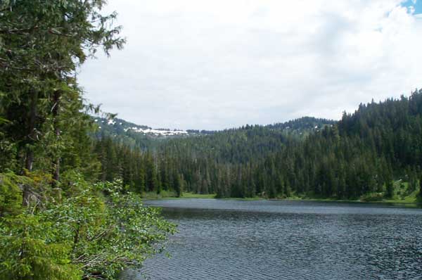
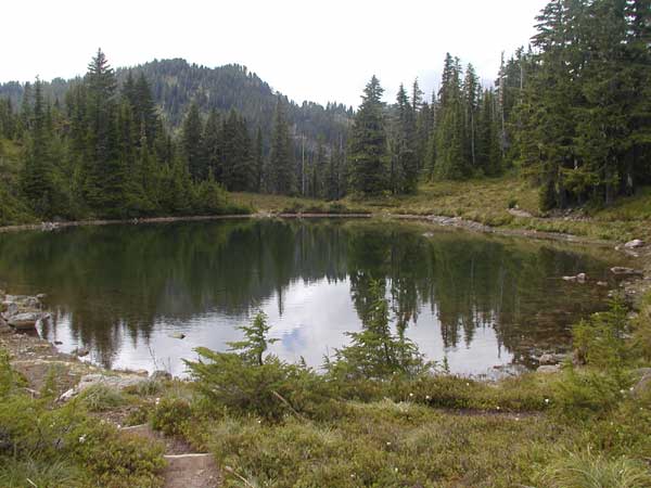
Deer Lake is a serene place. The first view from the river crossing is always welcome after the climb.
If you aren't up to the climb, or there is still snow in the high country, you can walk around Deer Lake
Another View of Deer Lake
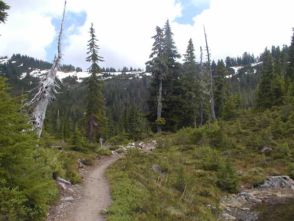
The trail is pretty enough here, but
it starts being something special
when you reach the canyon bridge. Here you meet the stream that will be
your companion for the climb, and here you can get a feel for the climb
out of the Sol Duc Valley you are undertaking. From here on, you will
never
be that far from the stream with its wild rapids, waterfalls and
comforting
roar. Up the rocky switchbacks, through the evergreen forests and up
into
a new world you go. Mind you, this trail can be hard going, but the
1500'
climb is worth it.
We were once struggling with the meaning of our existence as we climbed this trail, rock strewn and cougar infested, but then we ran into a twelve year old girl carrying a pack that probably weighed as much as she did. She was barreling along and we took heart. After all, we weren't going to let an overburdened twelve year old make us look like fogies. But, even she started to falter. "Where is this lake anyway?", she asked existentially. But by now, we were at 1400', so it was we, older and wiser, gasping and wheezing who offered HER hope. We had a digital altimeter and had checked the guidebooks, so we reassured her that there were only another hundred feet to climb.
Amazingly, the guidebook had been
correct and the altimeter not far from
the mark. We were indeed soon at the lake. There it was in alpine
splendor,
surrounded by snow, even late in the summer. It was gorgeous. It was
breathtaking,
that is, if we had had any breath left. We had to come back, and we
have
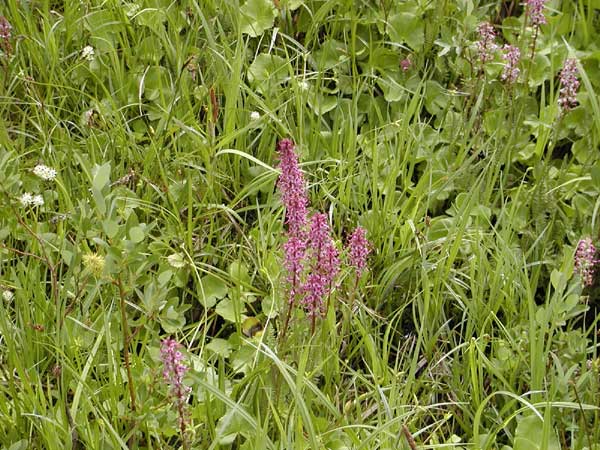
many times. On our last visit it was surrounded by wildflowers and we
took
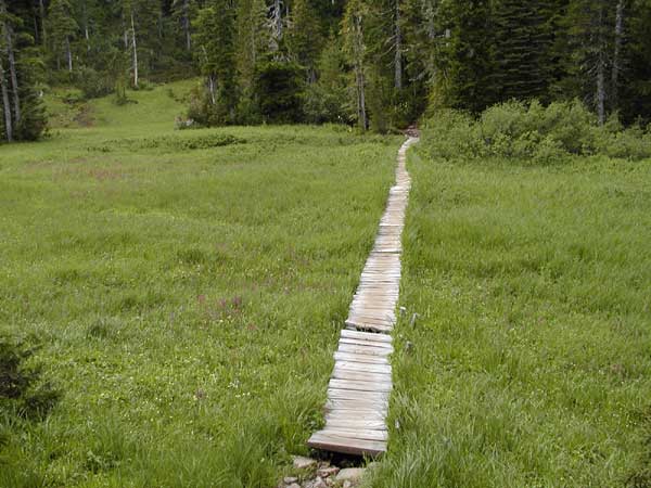
the walk around the lake which leads through forest and swamp, offering
a variety of views to enjoy and habitats to explore.
THE POTHOLES
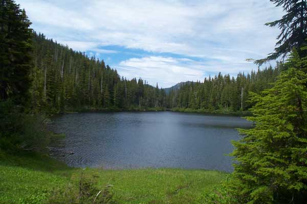
If you still have any strength, you might want to continue onward. Follow the trail, about 1/.4 the way around the lake, that leads on to the High Divide Trail (not towards Mink Lake). This ascends rapidly, but with better footing, than the original climb to Deer Lake. After you have climbed another 500' or so, you will start seeing the potholes, a series of ice melt lakes, in the most amazing settings.
Glacial Sinkholes In The High Country
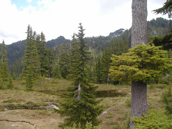
Alpine Forest at the Potholes
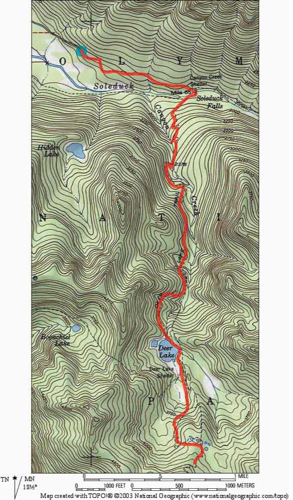
Click above for a trail map produced using National Geographic's TOPO program.